
Lyle Convict road seen from the Columbia, circa 1915

Sam Hill photo of the Lyle Convict road seen from the Columbia, circa 1910, courtesy of Maryhill Museum
These next few photos are Sam Hill’s personal colorized photos recording the 1910 building of his convict road over the Lyle bluffs. These photos are courtesy the Maryhill Museum archives.

The walled convict camp built at the west end of the Lyle bluffs on the grassy slope.

The 1910 Lyle convict prison camp looking across the Columbia to Rowena area.

Convicts building Sam Hill’s road east of Lyle Washington, 1910

Convicts laboring on Sam Hill’s Lyle Convict road
This next photo is circa 1920 and it is a photo from Oregon’s Rowena Loops on the Historic Hwy, but in the background you can see most all of Lyle (built upon a smooth slope of a Missoula Flood-borne gravel bar)…and you can still see at the far right the remains of the 1910 Lyle convict prison camp.

Circa 1920 Lyle, showing convict prison camp, as seen from Oregon

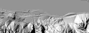
Present-day Convict road area, as seen from the Columbia

Present-day Convict gals walking and working the Convict Road. Imagine the prison cat fights!!

2011 photo of the still-solid masonry along the roadbed
")
2011 pic of the Convict roadbed above the Hwy 14 Lyle tunnels (looking west)

great work and enjoy your book. what is the cement section in the middle of the convict road….just to container rockfall?
Yup…seems to be rock fall containment. Happy exploring!!….scott
Thanks for digging up the historical photos, very interesting to compare. Just hiked this last weekend and the amount of rockfall is kind of amazing. Lucky for highway 14 there’s this pre-built catchment for the rocks.