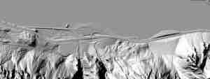

Summit Creek Falls area, as seen from Wa. Summit Creek falls is in gully to the right of the rock lump.

Summit Creek Falls hiking route (Camp Benson falls)

Summit Creek Falls hiking route, with remnant of the Historic Highway

Summit Creek Falls hiking loop parking off I-84
 covered in mosses")
Section of the Historic Highway (HCRH) covered in mosses

The Historic Hwy path towards Summit Creek falls

Summit Creek Falls, also known historically as Camp Benson falls

Camp Benson falls, or Lower Summit Creek falls
")
Upper Summit Creek Falls (about 15 feet tall)

This turned out to be a pleasant surprise, even though we did not make it up to the waterfall. The limiting factor is the nature of the rock pile that partially fills the small canyon containing Summit Creek. To make it up to the falls, you have to scramble for maybe 100 yards over this big pile of rocks. Normally that might be fun, but these rocks were not created naturally. They were created by blasting and the size and shape make them very dangerous to clamber over. Lots of sharp edges and unstable chunks. If you must go up to the falls, be very careful.
Now for the good part. The walk up the section of the moss covered “Old Highway” was very pleasant. Only saw a touch of poison oak along the edge.
Upon arriving at the little canyon of Summit Creek, we were suprised to see a splashing alpine stream descending in several pools surrounded by grass and flowers. OK, it was also surrounded by a lot of big sharp rocks too, but it was worth it to pick our way over these.
The water was not too cold and great for splashing around in or soaking your feet. Good place for skinny dipping since you are (just barely) out of view of the freeway.
There is probably a very short window of time/weather when these perfect conditions exist. We visited on June 5th 2010, which was the first sunny 70+ degree day after a wet, cold spring. So I’d guess that any sunny days in May or early June might be good. Later in the summer the little canyon turns into a furnace.
We did this scramble, bushwacking style, last week. It is almost the most beautiful sight ever. it is so green and lush and so worth the energy that it takes to cross the creek twice and climb up the hill. It is the best kept secret in the gorge. I have done it twice in the last month and will again before the water level goes way down.
We paired this scramble with Gorton Creek Falls #30. First, the driving directions were so precise I was relieved. We had young kids with us and wanted to lure them into hiking. This scramble is quite a bit more adventurous for kids than Gorton Creek Falls. However, with some careful navigation and parental guidance, they both made it to the top of the falls. The moss covered old highway was beautiful and the view of the Washington side was amazing….even with I84 in the background. Im curious how far those roads go under the power lines….anybody? Another secret waterfall that is gorgeous! Thank you!